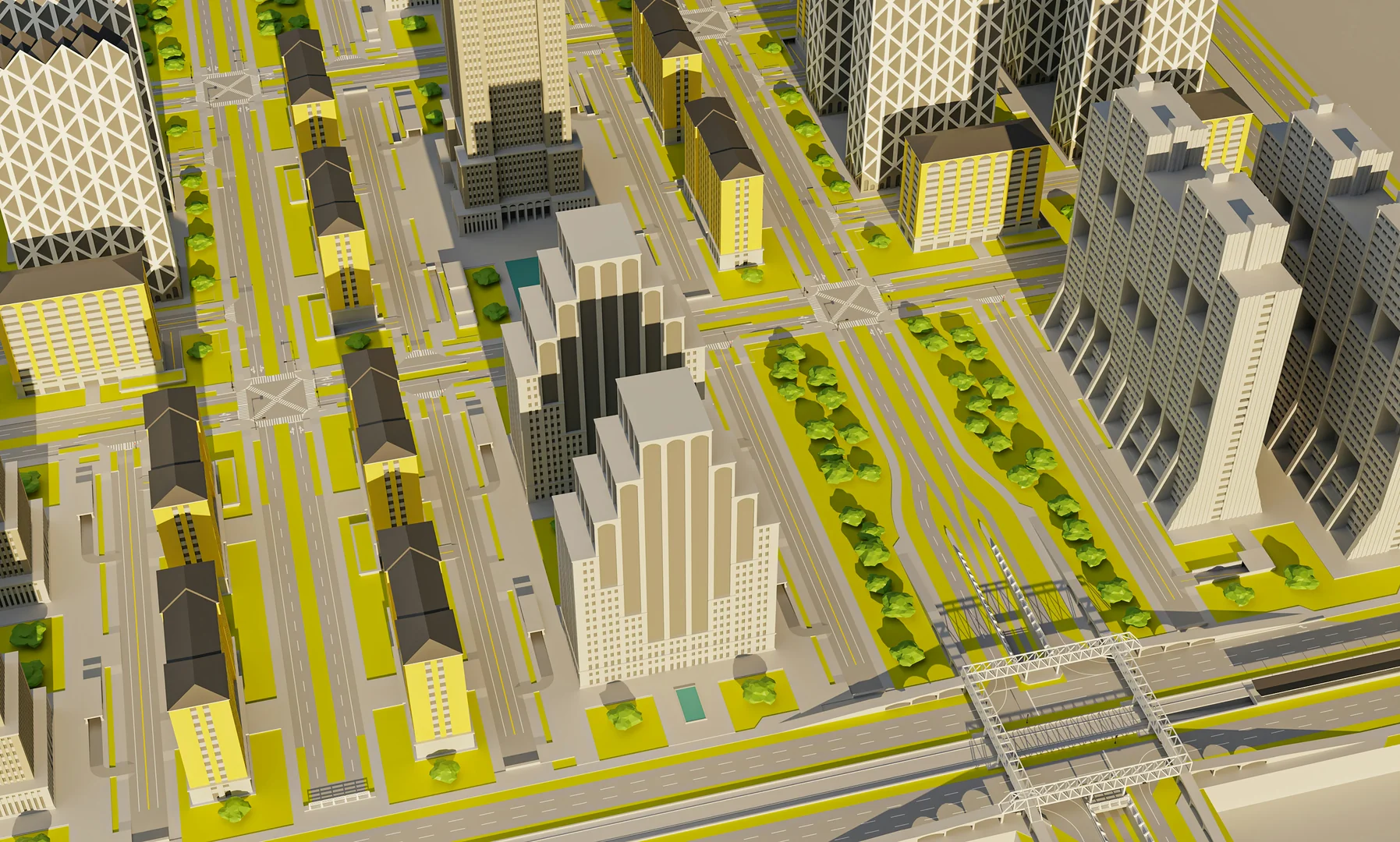
Plots
Development
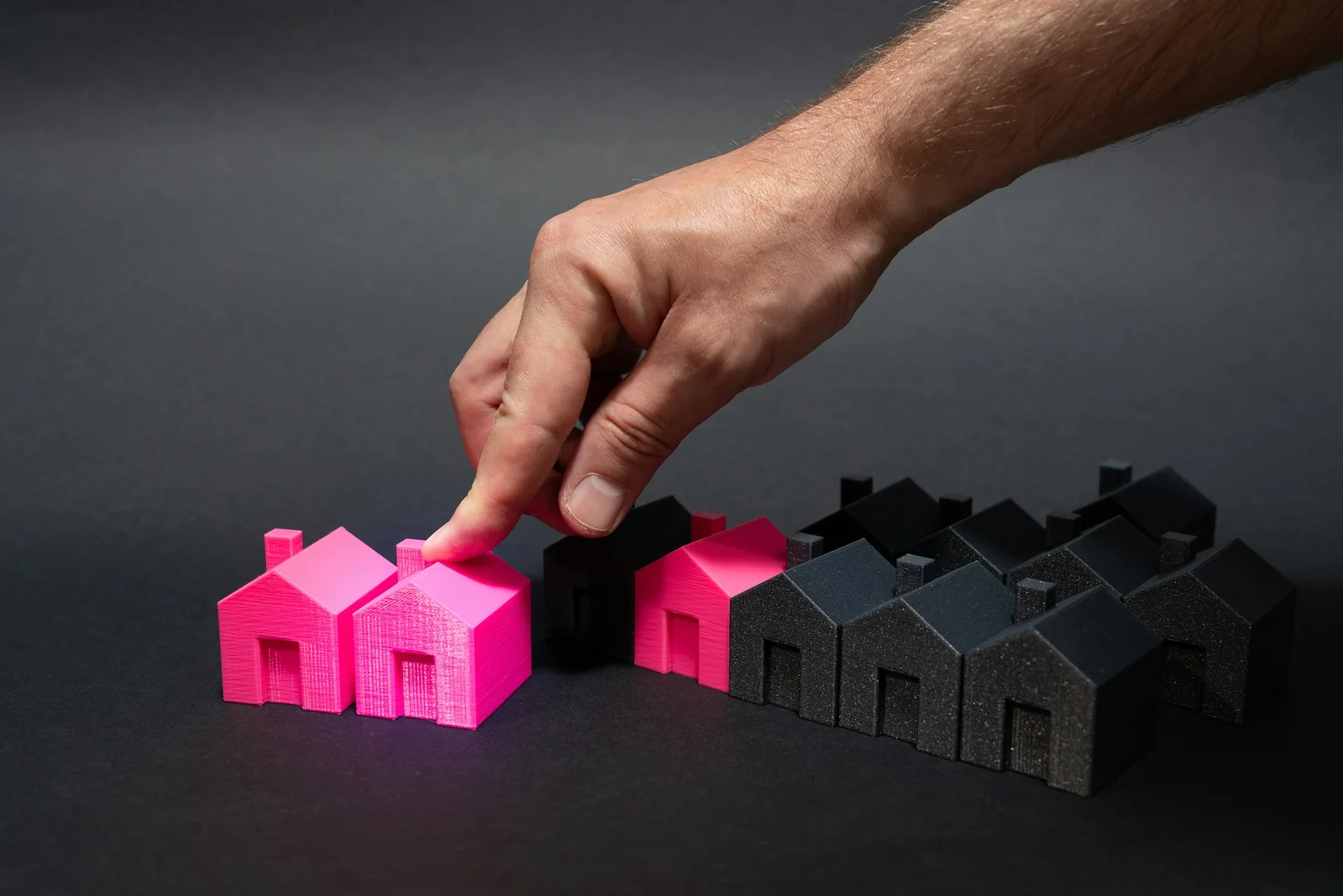
Danger Zones Property Valuation

Investments in real estate carry risks. A professional hazard zone property assessment helps you identify these risks and make informed decisions. Would you like to learn more about the possibilities of individual consultation? Get in touch with us here.

The valuation of properties in hazard zones requires special expertise and the consideration of natural hazards to minimise financial risks.
By adapting traditional evaluation methods and utilizing risk-based evaluation models, the accuracy of valuations can be significantly improved, potentially optimizing investment returns by up to 3%.
Technological developments such as GIS, AI, and Big Data offer new opportunities for improving assessments and adapting to climate change, which requires risk-aware actions.
Introduction to Property Valuation in Hazard Zones
Property valuation in hazard zones presents a particular challenge. Standard procedures are often insufficient to adequately account for the specific risks posed by natural hazards. This article provides you with a comprehensive overview of the subject and outlines approaches to take when assessing methods for properties in risk areas. A professional risk assessment is essential in order to realistically estimate the actual value of a property and minimise financial risks.
Definition and Relevance of Hazard Zone Property Valuation
Hazard zones are areas where there is an increased risk from natural hazards such as floods or landslides. These risks significantly affect the value and usability of properties. A specialised valuation is necessary because standard procedures often do not adequately consider these hazards. Therefore, the risk assessment must be an integral part of the valuation process to ensure a realistic estimation of property value. Taking into account the flood and landslide risks is crucial to anticipate potential damages and their financial implications.
Purpose of the Article
This article provides you with a comprehensive overview of the challenges and solutions in hazard zone property valuation. We show you how to consider legal and normative foundations, which valuation methods are suitable, and which factors influence property values in hazard zones. We also discuss the challenges in valuation and present case studies and best practices. Finally, we take a look at technological developments and future perspectives. Our goal is to provide you with the knowledge needed to make informed decisions when valuing properties in hazard zones and to minimise financial risks. For further information on contaminated sites, please see our article on recognising contaminated sites in properties.
Legal and Normative Foundations
The hazard zone property valuation is governed by various laws and standards. In Germany, the Building Code (BauGB) and the Spatial Planning Act (ROG) are significant, setting the framework conditions for the construction and use of properties. The Water Resources Act (WHG) and flood protection laws regulate the management of water and protection against flood hazards. In Austria, similar laws and regulations govern the handling of natural hazards. In addition, there are ÖNORM standards and guidelines for risk assessment that must be considered when evaluating properties in hazard zones.
Importance of Development Plans and Hazard Maps
Development Plans and hazard maps play a crucial role in property valuation in hazard zones. Development plans specify the types of developments permitted in an area and the conditions that must be met. Hazard maps provide information about the type and extent of risks from natural hazards such as flooding or landslides. These maps can establish building prohibitions or conditions for certain areas. It is therefore essential to consider this information when evaluating properties in hazard zones to identify potential risks and restrictions. The integration of Geographic Information Systems (GIS) enables a detailed analysis of these maps and contributes to accurate risk assessment.
Liability Issues and Responsibilities
In the event of damage caused by natural hazards, liability questions arise. Property owners are generally liable for damage caused by their property if they have breached their duty of care. Authorities can also be held liable if they have neglected their duties to avert danger. It is therefore important for property owners and authorities to be aware of their responsibilities and take appropriate measures to mitigate hazards. An elemental damage insurance can protect against financial risks. The factors influencing trust in online reviews are also relevant here, as they can affect the perception of risks and responsibilities.
Methods of Property Valuation in Hazard Zones
In property valuation in hazard zones, traditional valuation methods must be adapted to account for specific risks. The comparison method can be modified by considering the sale prices of similar properties in hazard zones and adjusting them based on risk factors. With the income capitalisation approach, rental income and management costs need to be adjusted to consider maintenance costs due to hazards. The replacement cost method requires an adjustment of construction costs and land value, taking into account safety measures and protective structures. These adjustments are crucial to ensure realistic valuation in hazard zones.
Risk-Based Valuation Models
Risk-based valuation models allow for a more precise assessment of property value in hazard zones. Here, risks are quantified by determining the probability and magnitude of potential damage. The capitalisation rate can be adjusted by increasing it to account for the risk. Risk deductions can also be considered. Monte Carlo simulations enable the simulation of various scenarios for risk assessment and the determination of probability distributions for property value. These models help reduce uncertainties in the valuation of properties in hazard zones and make informed decisions. The dynamics of online marketplaces demonstrate the importance of trust and transparent information in risk assessment as well.
Quantification of Risks
The quantification of risks is an essential component of property valuation in hazard zones. The probability and magnitude of potential damage are determined. Probability can be estimated based on historical data, modelling, and expert opinions. The magnitude of damage depends on the type and extent of the hazard, as well as protective measures. By quantifying the risks, they can be included in the valuation and the property value adjusted accordingly. Risk-based valuation models aid in realistically assessing the financial impact of natural hazards and making informed decisions. Our analysis of value assessment in earthquake zones provides further insights into risk quantification.
Factors Influencing Property Value in Hazard Zones
The value of properties in hazard zones is influenced by various factors. The type and extent of the threat play a decisive role. A high flood risk or landslide risk can significantly decrease the value. Earthquake risk also affects value, particularly if buildings are not earthquake-resistant. Protective measures such as flood protection walls or slope stabilization methods can positively impact the value as they reduce the risk. Insurability and the level of insurance premiums are also important factors that affect the attractiveness of the property.
Type and Extent of the Threat
The type and extent of the threat are crucial factors influencing property values in hazard zones. For flood risk, the probability and severity of flooding are important considerations. These factors affect the building structure and usability of the property. The landslide and slope failure risk depends on the stability of the soil and terrain. A threat to buildings and infrastructure can significantly decrease the value. For earthquake risk, seismic activity and the nature of the ground are significant. The requirements for earthquake safety in buildings also impact value. A detailed analysis of these factors is essential to realistically assess property values in hazard zones.
Protective Measures and Their Effectiveness
Protective measures can positively impact property values in hazard zones. Flood protection measures such as dikes, walls, and retention basins reduce flood risk and increase the property's safety. Slope stabilization measures like retaining walls, netting, and planting stabilize the soil and prevent landslides. Earthquake-resistant construction with special building techniques and materials reduces damage risk during earthquakes. The effectiveness of these protective measures must be taken into account during valuation. A professional risk assessment can quantify the impact of protective measures on property value. Our land development services help you identify and implement the right protective measures.
Challenges in Assessment and Approaches to Solutions
The valuation of properties in hazard zones comes with various challenges. A lack of detailed hazard maps and uncertainties in risk assessment can complicate evaluations. The subjectivity of risk assessments, arising from differing expert judgments, also presents a challenge. Information deficits among buyers and sellers can lead to poor decisions. To address these challenges, solutions such as using geodata and modelling, standardising evaluation procedures, and creating transparency and communication are essential.
Data Availability and Quality
A shortage of detailed hazard maps and uncertainties in risk assessment present a significant challenge in property valuation in hazard zones. To tackle this issue, utilising geodata and modelling is indispensable. Detailed land data collection and the creation of high-resolution risk maps can improve the data basis. The integration of Geographic Information Systems (GIS) enables a comprehensive analysis of hazard zones. By employing these technologies, the uncertainties in risk assessment can be reduced, and the quality of the evaluation improved. The methodology for network visualisation can also be applied here to better understand and communicate risk data.
Subjectivity of Risk Assessment
The subjectivity of risk assessments poses another challenge in property valuation in hazard zones. Differing expert evaluations can lead to varying assessments. To reduce this subjectivity, standardising evaluation procedures is necessary. The development of guidelines and checklists can help make the assessment more objective and understandable. Incorporating interdisciplinary teams with experts from various fields can also enhance the quality of the evaluation. Through standardisation and expert inclusion, the subjectivity of risk assessment can be minimised, ensuring an informed evaluation.
Transparency and Communication
Information deficits among buyers and sellers can lead to poor decisions in property valuation in hazard zones. To avoid this, disclosure obligations and comprehensive advice are required. Buyers and sellers must be informed about the hazards and risks involved. Advice from independent assessors can aid in realistically evaluating risks and making sound decisions. Through transparency and communication, information deficits can be reduced, and trust in valuations can be strengthened. Our consultancy in the real estate sector helps you make the right decisions.
Case Studies and Best Practices
Examining case studies and best practices can provide valuable insights for property valuation in hazard zones. Presenting specific projects and analysing the methods and outcomes used demonstrate what successful valuation can look like in practice. Analysing success factors and pitfalls helps to avoid mistakes and optimise the valuation. Reviewing international examples shows how other countries deal with similar challenges and which approaches are transferable.
Examples of Successful Property Valuations in Hazard Zones
Presenting specific projects and analysing the methods and outcomes used demonstrate what successful property valuation in hazard zones can look like in practice. The specific challenges and approaches of each project are considered. The analysis of the methods applied, such as the adaptation of valuation procedures or the application of risk-based valuation models, shows which approaches are particularly successful. The results of the valuation are analysed and compared with the actual conditions to verify the accuracy of the valuation. By analysing successful projects, valuable insights can be gained for one’s own valuation.
Lessons Learned
Analysing success factors and pitfalls in property valuation in hazard zones helps to avoid mistakes and optimise the valuation. Identifying success factors, such as the use of detailed geodata or the involvement of interdisciplinary teams, shows which factors are particularly important for a successful valuation. Analysing pitfalls, such as lack of information or subjectivity in risk assessment, helps to identify and avoid potential sources of error. From the lessons learned, recommendations can be derived for practice to improve the quality of the valuation. Our information on property value enhancement can help you optimise the value of your property.
International Examples
Reviewing international examples shows how other countries deal with similar challenges in property valuation in hazard zones and which approaches are transferable. Countries with similar natural hazards and legal frameworks are considered. The analysis of the valuation methods, protective measures, and political strategies used shows which approaches are particularly successful. The transferability of the solutions to one’s own situation is checked and adapted. By reviewing international examples, new perspectives can be gained and one’s own valuation optimised.
Technological Developments and Future Perspectives
The valuation of real estate in hazard zones benefits from technological developments and innovations. The use of Geographical Information Systems (GIS) enables the visualization and analysis of hazard zones and the integration of risk data into the valuation process. Artificial Intelligence (AI) and Machine Learning facilitate automated risk assessment and prediction of damages and value changes. Big Data and sensor data enable real-time environmental data capture and enhance risk modeling. These technologies help improve the accuracy and efficiency of valuations and support informed decision-making.
Use of Geographical Information Systems (GIS)
The application of Geographical Information Systems (GIS) enables the visualization and analysis of hazard zones and the integration of risk data into property valuation. GIS allows for the creation of detailed maps and models that depict the spatial distribution of hazards and risks. The integration of risk data, such as flood zones or landslide risks, allows for comprehensive hazard analysis. GIS also enables scenario simulation and damage prediction. By utilizing GIS, risks can be better understood and incorporated into the valuation process. Information on development costs can be integrated into GIS to better understand the economic impacts of hazard zones.
Artificial Intelligence (AI) and Machine Learning
Artificial Intelligence (AI) and Machine Learning enable automated risk assessment and prediction of damages and value changes in the valuation of real estate in hazard zones. AI algorithms can analyze historical data, model information, and expert opinions to estimate the likelihood and magnitude of damages. Machine Learning can identify patterns in the data and make predictions about future developments. Utilizing AI and Machine Learning enables faster and more precise risk assessment. Automating risk evaluation saves time and costs, allowing for informed decision-making. The issue of fake online reviews highlights the importance of data and algorithm validation to achieve reliable results.
Big Data and Sensor Data
Big Data and sensor data facilitate the real-time collection of environmental data and the enhancement of risk modeling in the valuation of real estate in hazard zones. Sensors can record data about rainfall, water levels, soil moisture, and other environmental factors. This data can be analyzed in real-time and used to improve risk modeling. Big Data allows the processing of large data sets and the identification of patterns and correlations. By employing Big Data and sensor data, risks can be assessed with greater accuracy, and valuations can be improved. The integration of real-time data allows dynamic adaptation of valuations to changing environmental conditions.
Conclusion and Outlook
The valuation of properties in hazard zones is of great importance to minimise financial risks and make informed decisions. The challenges in valuation, such as data availability, subjectivity, and transparency, can be addressed through approaches like the use of geodata, standardisation of assessment procedures, and the creation of transparency. Technological developments such as GIS, AI, and Big Data offer new opportunities to improve assessments. In the future, it will be essential to adapt to climate change and further develop valuation methods. Politics, business, and research must collaborate to promote risk-conscious behaviour and create sustainable values.
Summary of Key Findings
The valuation of properties in hazard zones requires special expertise and consideration of various factors. The type and extent of risk, protective measures and their effectiveness, as well as insurability and insurance costs, influence property value. Challenges in valuation can be overcome through the use of geodata, standardisation of assessment procedures, and the creation of transparency. Technological developments offer new opportunities to improve valuations. Professional risk assessment is essential to make informed decisions and minimise financial risks. Our services in property valuation help you realistically assess the value of your property.
Outlook on Future Developments
In the future, it will be crucial to adapt to climate change and further develop valuation methods. Climate change leads to an increase in extreme weather events such as flooding and landslides, which increase the risk in hazard zones. Valuation methods must therefore be adapted to the changed conditions. The development of new technologies and the use of Big Data will improve the accuracy and efficiency of valuations. The collaboration of politics, business, and research is vital to tackle the challenges of climate change and create sustainable values. Adapting to climate change requires risk-conscious behaviour and a willingness to invest in protective measures.
Recommendations for Politics, Business, and Research
To improve the valuation of properties in hazard zones and promote risk-conscious behaviour, recommendations for politics, business, and research are needed. Politics should create incentives for risk-conscious action and promote research and development in the field of valuation methods. Business should invest in protective measures and provide transparent information about the risks. Research should develop new technologies and valuation methods and examine the impact of climate change on valuation. Through the collaboration of politics, business, and research, the challenges of property valuation in hazard zones can be overcome and sustainable values created.
Secure your investment with accurate assessments and well-founded knowledge about risk areas. Discover how professional property valuation in hazard zones can help minimise financial risks and determine the true value of your property. Contact us today to start your individual consultation!
Conclusion
The valuation of properties in hazard zones requires a nuanced approach, the importance of data and information, and consideration of challenges and solutions. The role of technology and innovation, as well as the significance of sustainability and resilience, shape future developments. Owners, appraisers, and policymakers can contribute to securing property values in hazard zones by promoting protection measures and creating transparent frameworks. Property valuation is a complex process that requires expertise and experience.
Summary of Key Findings
The key points of property valuation in hazard zones include the need for a differentiated approach, the importance of data and information, and identifying challenges and solutions. A careful analysis of the hazard situation, consideration of legal frameworks, and the application of suitable valuation methods are crucial in ensuring a sound and realistic valuation.
Outlook on Future Developments
The valuation of properties in hazard zones will advance through the role of technology and innovation. The use of AI and Big Data enables automated risk analysis and more accurate forecasts of damage events. The importance of sustainability and resilience will increase as climate change alters the risk landscape. Continuous adaptation of valuation methods to new challenges is essential.
Recommendations for Action for Owners, Appraisers, and Policy Makers
Owners can help secure the value of their property by promoting protective measures. Appraisers can ensure a well-founded valuation by applying appropriate valuation methods and considering specific risks. Policy makers can improve the valuation of properties in hazard zones through the creation of transparent frameworks and the promotion of data collection and provision.
Government grants and funding programs offer you an excellent opportunity to optimally protect your property in a hazard zone and maintain its value. Whether it concerns preventative measures or repairs after a damage event, the available funding programs and tax benefits make protecting your property attractive and financially achievable.
With a variety of funding programs and tax incentives, there are numerous ways to reduce the costs of protective measures. At Auctoa, we offer you comprehensive advice and support in selecting the right measures, meeting technical requirements, navigating the application process, and avoiding potential issues.
By opting for a professional valuation and the implementation of suitable protective measures, you are investing in the future of your home. You not only reduce potential damages and ensure a constant quality of life but also make a valuable contribution to maintaining the value of your property.
Now is the perfect time to explore funding opportunities for your project. Contact us today to start your individual consultation and to submit your funding application quickly and easily. Register for free and receive an immediate estimate for your property's renovation needs.
Umweltbundesamt (UBA) provides information on flood prevention and protection against floods.
Wikipedia offers an article about earthquakes in Germany.
What are the biggest challenges in property valuation in hazard zones?
The biggest challenges are the consideration of specific risks from natural hazards such as floods and landslides, the adaptation of traditional valuation methods, and the quantification of risks.
What role do development plans and hazard zone maps play in the valuation?
Development plans determine what construction is permitted, while hazard zone maps provide information on the type and extent of the hazard. Both are crucial for identifying potential risks and limitations.
How are traditional valuation methods adapted to hazard zones?
The comparison method is adjusted by considering the sale prices of similar properties in hazard zones. In the income approach, rental income and operating costs are adjusted, and in the cost approach, construction costs and land value are adjusted.
What protective measures can positively influence property value in hazard zones?
Flood protection measures such as dikes and walls, slope stabilisation measures, and earthquake-resistant construction can positively influence value by reducing risk.
What role do geographic information systems (GIS) play in valuation?
Geographic information systems (GIS) enable the visualisation and analysis of hazard zones and the integration of risk data into the valuation, contributing to a more accurate risk assessment.
How can buyers and sellers be protected from poor decisions?
Through disclosure obligations, comprehensive advice, and the involvement of independent experts, buyers and sellers can be protected from poor decisions.
What technological developments improve property valuation in hazard zones?
Artificial Intelligence (AI) and Machine Learning enable automated risk assessment and the prediction of damage and changes in value.
How does climate change affect property valuation in hazard zones?
Climate change leads to an increase in extreme weather events, which raises the risk in hazard zones, thus requiring adjustments to valuation methods.